AI-assisted sensor fusion for localizing underground water breaches
AI-assisted sensor fusion combines data from acoustics, thermography, pressure sensors, fiberoptics, mapping and analytics to refine where underground water breaches occur. Integrating multiple signals helps reduce false positives and supports validation of suspected leaks for targeted field inspections.
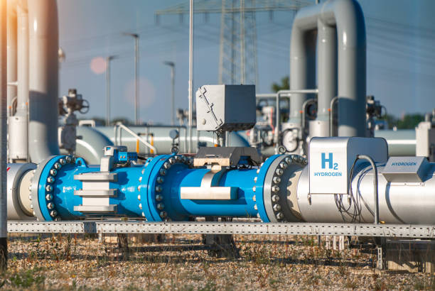
Underground water breaches present detection challenges because signals are diffuse, noisy, and influenced by soil, hydraulics, and infrastructure conditions. AI-assisted sensor fusion uses algorithms to combine signals from multiple modalities so anomalies stand out more clearly than with any single sensor. This approach supports faster localization, improved mapping of likely leak zones, and better validation of field observations, while helping utilities and local services prioritize inspections and repairs.
How do acoustics contribute to detection?
Acoustic sensors pick up sound waves produced by pressurized water escaping pipes; these signals vary with pipe material, flowrate, and surrounding soil. Acoustics provide continuous monitoring and are sensitive to active leaks, but are also prone to background noise. AI models can filter and classify acoustic signatures, flagging probable leak events and reducing false anomaly alerts. Together with calibration routines and triangulation using multiple acoustic nodes, fusion improves spatial confidence prior to dispatching crews.
Can thermography reveal underground leaks?
Thermography detects temperature differences at the ground surface or on accessible infrastructure that result from escaping water, especially when temperatures contrast with ambient soil. Infrared imagery complements other sensors by visualizing thermal anomalies that may indicate wet zones. In cooler climates or during certain diurnal cycles, thermography helps map probable leak extents. When combined with pressure data and analytics, thermographic evidence strengthens validation of suspected breach locations.
What role do pressure sensors play?
Pressure sensors measure changes in hydraulic regimes that often precede or accompany leaks. Sudden drops, persistent low-pressure zones, or fluctuating patterns point to system anomalies. Pressure data are useful for broad-area screening and for triggering targeted acoustic or fiberoptic scans. Calibration of pressure sensors and understanding baseline hydraulics are essential to avoid misclassifying transient events. In fusion pipelines, pressure trends provide temporal context for anomalies detected by other modalities.
How are fiberoptics used in localization?
Fiberoptic sensing, including distributed acoustic sensing (DAS) and distributed temperature sensing (DTS), converts a fiber line into a long, continuous sensor. This technology supports high-resolution mapping along linear assets, detecting both acoustic signals and thermal changes. Fiberoptics integrate with AI to perform automatic triangulation and mapping of anomalies relative to known coordinates. Proper calibration and validation against ground-truth events are key to interpreting signals affected by installation conditions and soil contact.
How does mapping and triangulation work?
Mapping combines geospatial reference data with sensor readings to produce actionable maps of likely leak zones. Triangulation uses signal timing, amplitude differences, or multi-sensor geometry to estimate a leak location. Fusion systems weight inputs—acoustics, pressure deviations, thermography hot spots, and fiberoptic traces—based on calibrated sensor models and historical analytics. The result is a ranked map that guides inspectors to precise locations while also recording confidence metrics for each candidate anomaly.
How do analytics and validation improve accuracy?
Analytics layer machine learning and statistical models on fused inputs to recognize leak signatures and suppress background events. Validation involves comparing predicted locations against excavations, tracer tests, or confirmed repairs to refine models and recalibrate sensors. Continuous learning pipelines update models with new labeled anomalies so precision improves over time. Operational workflows that tie analytics outputs to field verification close the loop between detection, calibration, and ongoing model validation.
Conclusion AI-assisted sensor fusion for underground water breaches brings together acoustics, thermography, pressure sensors, fiberoptics, mapping, triangulation, calibration, hydraulics understanding, anomaly detection, analytics, and validation into an integrated detection strategy. By leveraging complementary strengths of each modality and applying AI to filter and weight signals, utilities and service providers can generate more reliable localization maps, reduce unnecessary excavations, and make inspections more efficient. Successful deployments depend on careful calibration, quality data, and routine validation against ground truth to maintain detection accuracy.

